The history of the names of the streets surrounding La Mirada come from the varied names of the people and land that affected the residents of this shining city on a hill.
Imperial Highway Was Named After the “Imperial Highway Association”
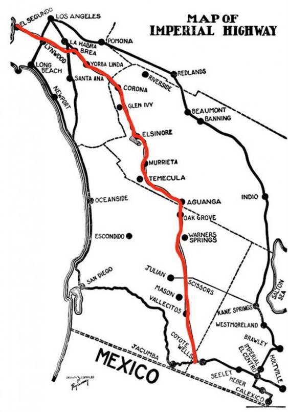 “Imperial” refers to Imperial County. The road is named thus because it was part of a grand scheme by the “Imperial Highway Association” set in motion in 1929, to expedite the transport of Imperial County’s fresh produce to Angelenos along a 220 mile paved thoroughfare between El Centro and El Segundo. The saga of Imperial Highway is that it was finally completed in December 1961 – only to have various segments lose the Imperial name. In Los Angeles, portions of 114th Street and 116th Street were renamed Imperial Highway in 1930 and 1931, respectively. The road keeps its name for 41 miles until it reaches the city of Orange, whereupon it becomes Cannon Street.
The official route of the Imperial Highway was adopted in January 1931. At the suggestion of Bob Hayes, manager of the El Centro Chamber of Commerce, it followed the old Butterfield stage route across the desert and along today’s Highway 79 to Temecula, where it headed on to Corona via Lake Elsinore and Temescal Canyon.
The saga of Imperial Highway is that it was finally completed in December 1961 – only to have various segments lose the Imperial name. In Los Angeles, portions of 114th Street and 116th Street were renamed Imperial Highway in 1930 and 1931, respectively. The road keeps its name for 41 miles until it reaches the city of Orange, whereupon it becomes Cannon Street.
The road turned left down the Santa Ana Canyon on its way to Yorba Linda and La Habra, then across Los Angeles County to meet the sea at El Segundo. It was billed as the “cannonball route” – a straight shot from the desert to the sea – but it still managed to wind its way through most of the cities where support for the plan was strongest. 1930 saw the start of construction on this so-called “Imperial Highway,” a new road through southern Los Angeles County, northern Orange County, through the Santa Ana River Canyon into Riverside County, then southeasterly into San Diego and
Imperial Counties via the old “Butterfield” stagecoach route, which ended in 1861 due to the Civil war, and other smaller coach routes, like the one that traversed through La Mirada near the Stage Coach Stop and Relay Station at Imperial Highway and Cordova.
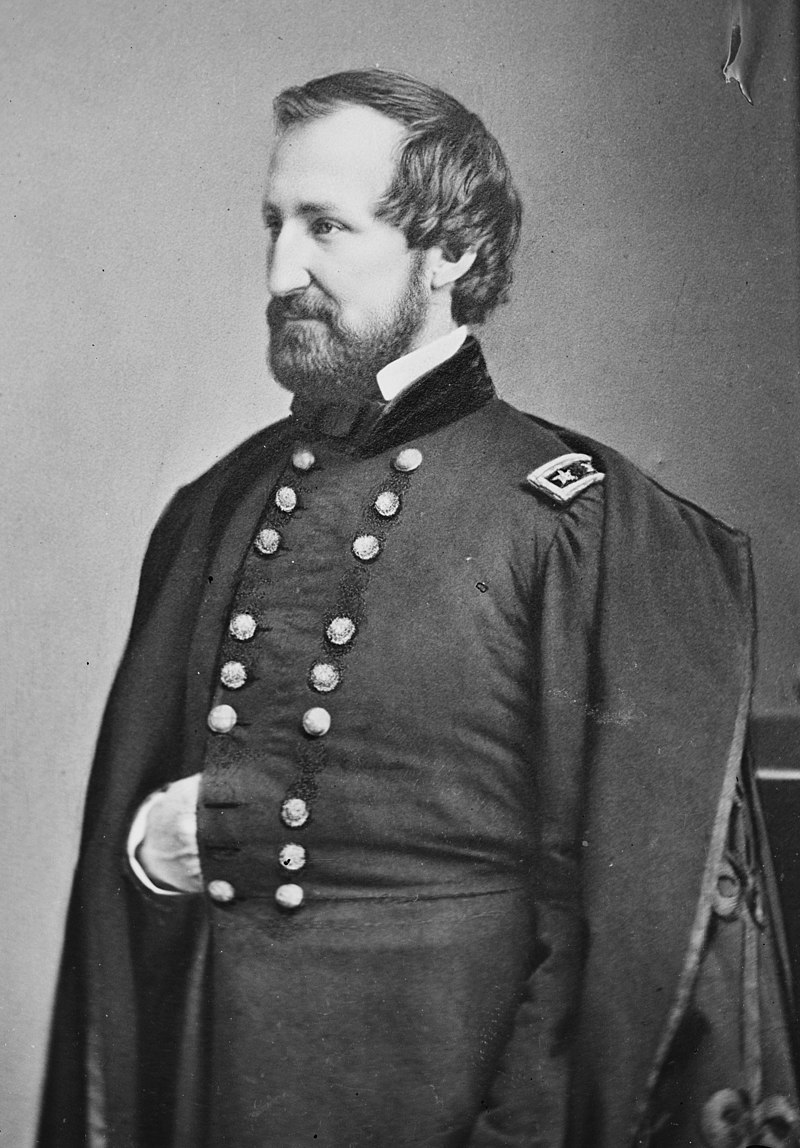
Rosecrans Avenue – Named After U.S. Union General William S. Rosecrans
Rosecrans Avenue is a major west-east thoroughfare in Los Angeles and Orange Counties, California, USA. It has a total length of 27.5 miles. The street is named after U.S. Union General William S. Rosecrans, who purchased 13,000 acres (5,300 ha) of Rancho Sausal Redondo southwest of Los Angeles in 1869.
Rosecrans Avenue was originally named Drexel Avenue and ran through the Rosecrans Rancho which is part of modern-day Gardena. Rosecrans originally dead-ended at Valley View and then picked up again after Luitwieler Avenue on the East near the cemetery. Rosecrans was rerouted down to the shopping area and the old Rosecrans near the cemetery was renamed Alicante Road. (From Bob Camp’s From La Mirada: From Rancho to City)
Stay Tuned for Part 2 will address the history of Santa Gertrudes Avenue, La Mirada Blvd. (Formerly Luitwieler Avenue), Alondra Boulevard, Valley View Avenue, Biola Avenue (Formerly Ranch Road), Stage Road, Beach Boulevard, and Firestone Boulevard.


