The history of the names of the streets surrounding La Mirada come from the varied names of the people and land that affected the residents of this shining city on a hill.
Santa Gertrudes Avenue
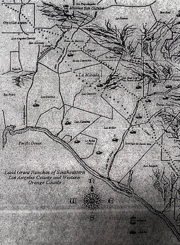
Named after Rancho Santa Gertrudes was a 21,298-acre (86.19 km2) 1834 Mexican land grant, in present-day Los Angeles County, California, resulting from a partition of Rancho Los Nietos. A former site of Nacaugna native americans, the rancho lands included the present-day cities of Downey, Santa Fe Springs and the northern part of Norwalk. The southern border between Ranchos Santa Gertrudes and Los Coyotes exists today as Leffingwell Road. The street Santa Gertrudes Avenue, which runs from Los Angeles County Route N8 to California State Route 72, is named after the rancho.
La Mirada Blvd./ Formerly Luitwieler Avenue
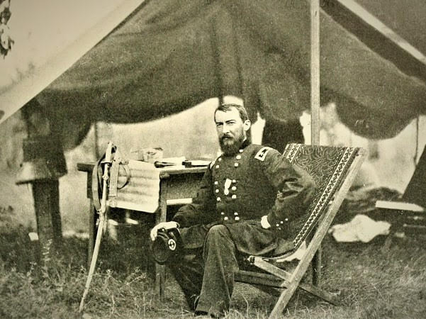
Luitwieler Avenue, renamed La Mirada Boulevard in 1966, was formerly known as Luitwieler Avenue after Samuel Woods Luitwieler who bought acreage in East Whittier around 1900 and plotted an early subdivision. Samuel Woods Luitwieler (1847-1931) enlisted Company I, 1st New York Veteran Cavalry Regiment, 24 September 1863, and was a corporal and quartermaster-sergeant; was attached to the Army of West Virginia, and engaged in the battles of New Market, Piedmont, Leetown, Monocacy, Charlestown, and Halltown. The faded inscription on the photo reads: “S W Luitwieler dispatch carrier for Gen. Phil Sheridan in the Shenandoah Valley 1864.” From the private collection of Denise Bartholome, great granddaughter of Samuel.
Luitwieler Avenue Rerouted
Luitwieler Avenue originally curved down to Alondra from Rosecrans. It was later curved South/East from Rosecrans and was finally connected to Beach Blvd South of Alondra in 1958.
Old Luitwieler Renamed Escalona
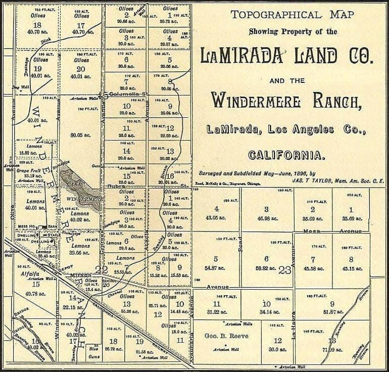
The original portion of Luitwieler Avenue South of Rosecrans was renamed Escalona Drive. (From Bob Camp’s Book “La Mirada: From Rancho to City”) The original name of La Mirada Boulevard was Araucaria Avenue on the La Mirada Land Company Map of 1896.
Valley View Avenue
The original name of Valley View was Olive Avenue from the 1896 La Mirada Land Company map. The original street names from 1896 in La Mirada Land Co. were as follows on the attached map. Olive Avenue, Windermere Avenue, Cypress Avenue, Acacia Avenue, Araucaria Avenue, Rubra Street, and La Mirada Avenue.
Biola Avenue (Formerly Ranch Lane)
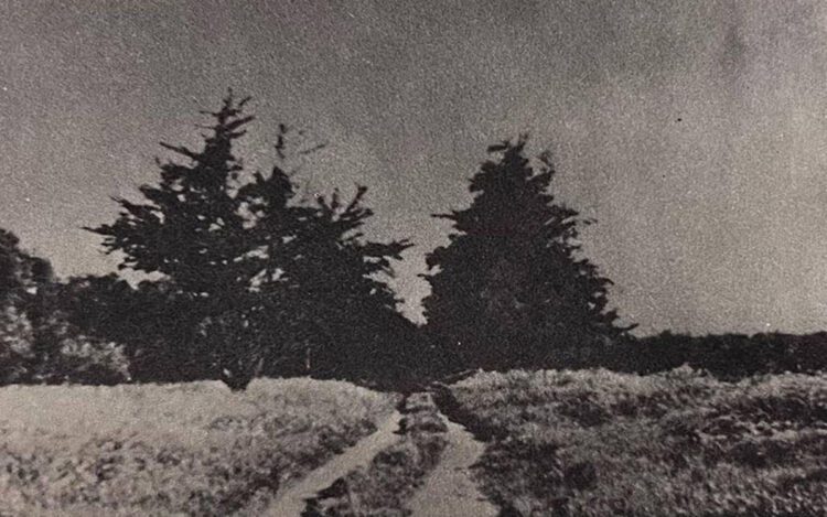
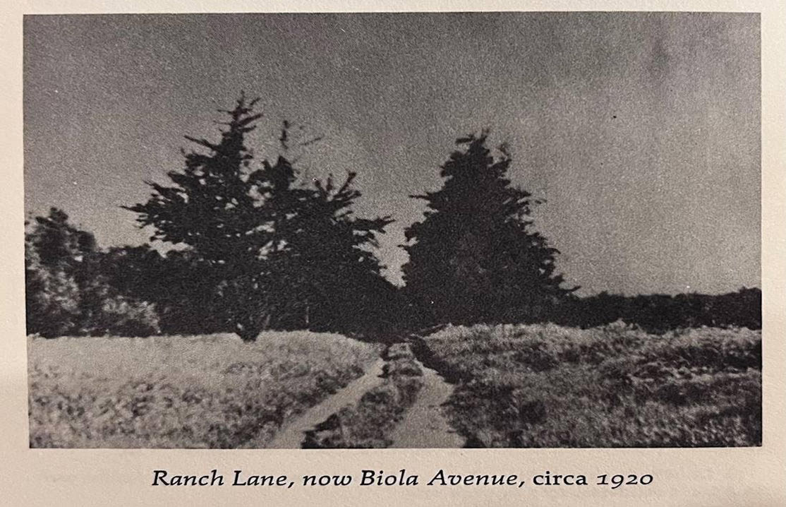
Biola Avenue, which runs from Stage Road to Imperial Highway, was formerly known as Ranch Lane as part of the McNally Ranch, it was a simple dirt road, See photo, then named Holder Avenue, a name given to the road by Andrew McNally for his friend named Holder, (from Biola President Sam Sutherland’s Memoirs) finally it was named Biola Avenue after the university moved to La Mirada and was being built in the 50s – Sutherland requested the name change to Biola Avenue.
Alondra Avenue
Alondra is Spanish for “lark”, as in the songbird. In 1926, the L.A. County Board of Supervisors announced plans to acquire a parcel of undeveloped land between Lawndale, Torrance, and Gardena and create a public space dubbed Alondra Park. The street was named after the park was built in January 1950
Firestone Boulevard
In July 1927, it was announced that the Firestone Tire and Rubber Company would build a $7 million tire factory, its first outside of Akron, on a 40 acre lot on Manchester Avenue between Alameda and Santa Fe. Just one month later, the County Board of Supervisors agreed to change the name of Manchester, east of Alameda, to Firestone Boulevard
Stage Road
Stage Road was formerly known as La Mirada Avenue on the 1896 La Mirada Land Map. With regard to Stage Coaches, From Bob Camp’s Book La Mirada: From Rancho to City: His discussion with Ed Paddison an early Norwalk-La Mirada Pioneer, Ed recalls from his early youth a wagon wheel rut road along the Santa Fe Railroad which could have been a switching station southward of the old Los Angeles-San Diego stage route and the forerunner for the naming of Stage Road. Although it is more likely a service road for the construction of the railroad. Bill Neff did not recall a stage route along the railroad….
Lower El Camino Real – Possibly Stage Road
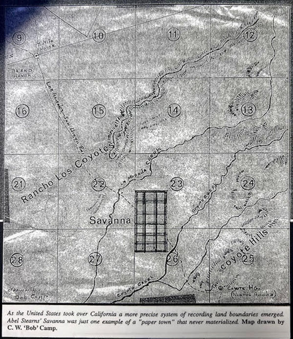
However another source states that Lower El Camino Real road ran through La Mirada and was in the area of Stage Road – which may have been part of the “Los Angeles-San Diego Stage Route”, which was established around 1868 that routed through the area known as “Savanna” which was a part of the Able Stearns “Stearns Rancho” planned community that never came to fruition in the La Mirada area. (Which is the subject of a future article on Stage Coaches which ran through La Mirada). But likely the stage coaches would run parallel to the railroads for various reasons (safety, convenience, pick-up and delivery of people and goods from the trains.)
Beach Blvd.
Portions of Beach Boulevard were formerly known as La Mirada Blvd./ Grand Avenue around the La Mirada area. It was a dirt road up to 1920. The entire road was referred to as Route 39. It was renamed “Beach Blvd.” around 1964.
Telegraph Road
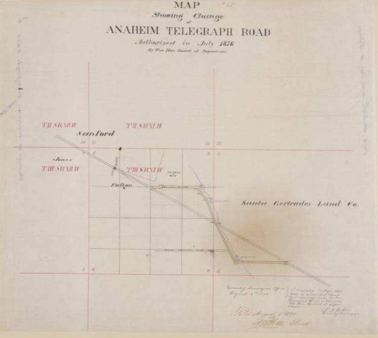
Telegraph Road was formerly known as Anaheim Telegraph Road in 1876. Telegraph Road, which runs along La Mirada’s northern border. The roadway was originally known as Anaheim-Telegraph Road because of the telegraph lines that connected Los Angeles to Anaheim. For a time, there was also a stagecoach line operated along the route. In 1952, the Los Angeles County Board of Supervisors approved the abbreviated name.

